File:DeysachinProvincesmap.png
Size of this preview: 800 × 512 pixels. Other resolution: 2,406 × 1,540 pixels.
Original file (2,406 × 1,540 pixels, file size: 296 KB, MIME type: image/png)
Summary
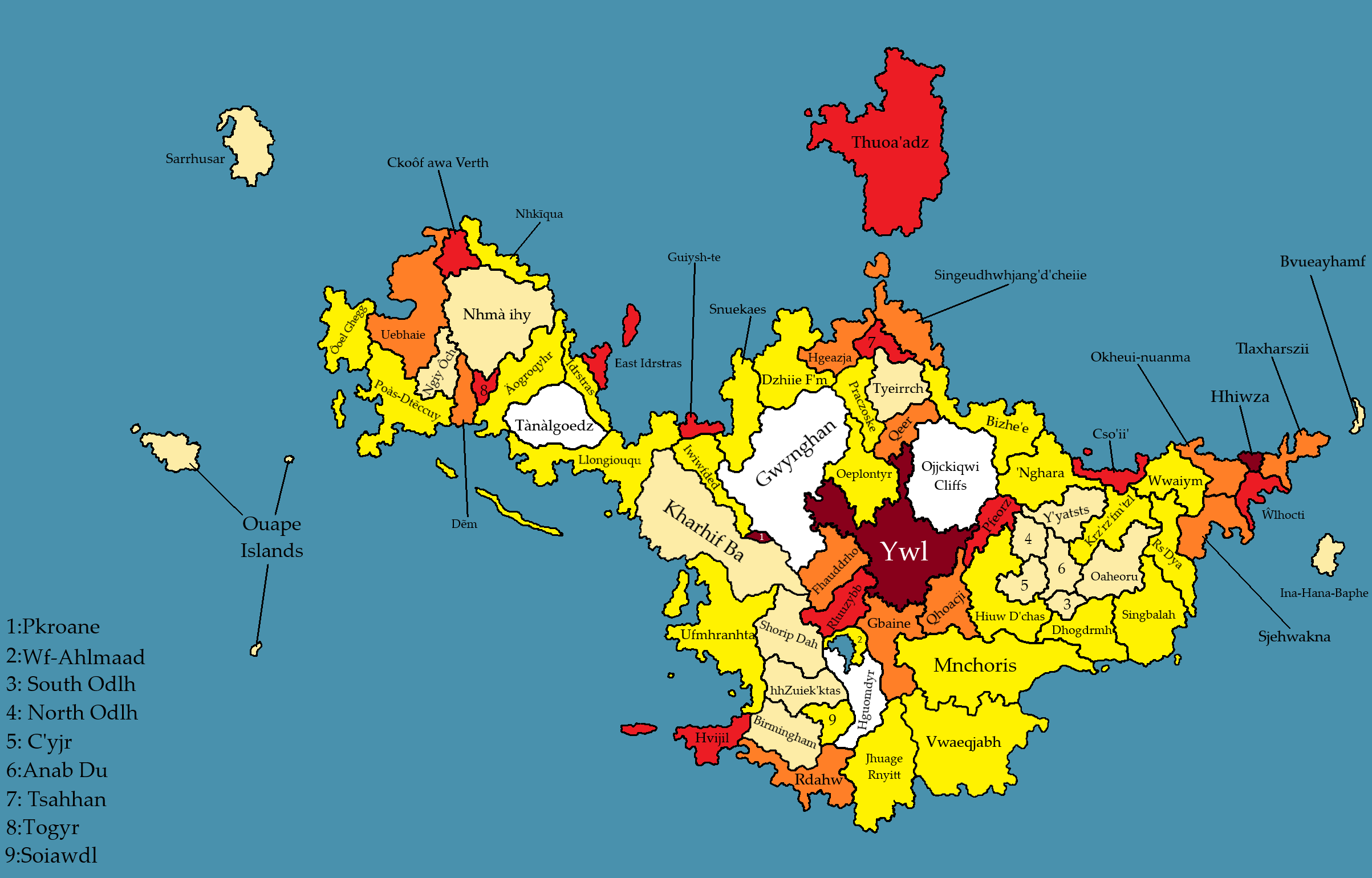
Map of deyachin provinces, color coded in some vague way based on population, idk if its density or raw numbers or some other shit idk its more vibes than anything.
File history
Click on a date/time to view the file as it appeared at that time.
| Date/Time | Thumbnail | Dimensions | User | Comment | |
|---|---|---|---|---|---|
| current | 03:26, 23 February 2024 | | 2,406 × 1,540 (296 KB) | Mr2112 (talk | contribs) | Map of deyachin provinces, color coded in some vague way based on population, idk if its density or raw numbers or some other shit idk its more vibes than anything. |
You cannot overwrite this file.
File usage
There are no pages that use this file.