File:Casea Map Political 27PC.png
Jump to navigation
Jump to search
Size of this preview: 634 × 600 pixels. Other resolution: 2,280 × 2,156 pixels.
Original file (2,280 × 2,156 pixels, file size: 862 KB, MIME type: image/png)
Summary
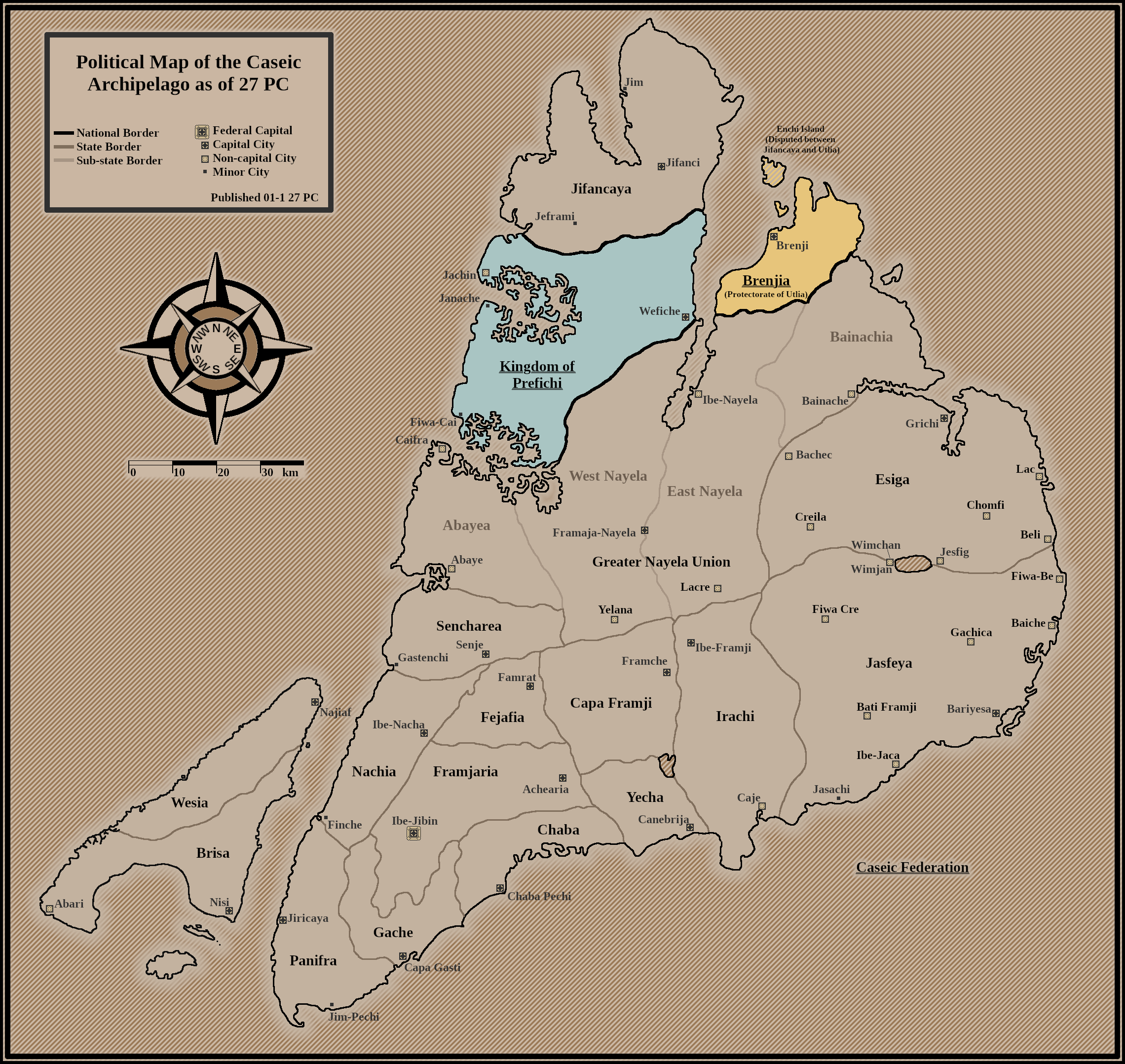
Political map of the Caseic Archipelago in 27 PC, during the First Great Attu War.
File history
Click on a date/time to view the file as it appeared at that time.
| Date/Time | Thumbnail | Dimensions | User | Comment | |
|---|---|---|---|---|---|
| current | 11:57, 17 March 2024 | | 2,280 × 2,156 (862 KB) | MtPenguinMonster (talk | contribs) | Political map of the Caseic Archipelago in 27 PC, during the First Great Attu War. Category:Caseic Federation |
You cannot overwrite this file.
File usage
There are no pages that use this file.