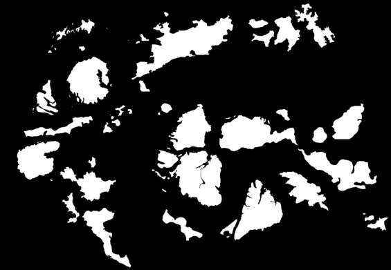
List of islands by land area

This data is based on a map of the Archipelago which has each island drawn at a 1px = 1km scale
Note: This list does not account for terrain ruggedness, build-able or developed land.
| Common Name | Land Area | Population | Population Density |
|---|---|---|---|
| Spyron | 29260±353 km2 | ||
| 22053±140 km2 | |||
| Nation of Niueyjar | 20823±116 km2 | 3,521,000 | 160 /km2 |
| Faltir | 18508±149 km2 | 0 † | 0 /km2 † |
| Caseic Federation | 18295±177 km2 | ||
| 15933±133 km2 | |||
| Nongba | 12220±84 km2 | 1,700,000 | 139 /km2 |
| eee | 10727±100 km2 | ||
| 8674 km2 | |||
| 9548±99 km2 | |||
| Utlia | 8,637 km2 | 850,000 | |
| Kingdom of Akaria | 7750±65 km2 | 500,000 | 183 /km2 |
| 7610±121 km2 | |||
| 7347±107 km2 | |||
| 4457±52 km2 | |||
| gonuela | 3635±70 km2 | ||
| Okrit | 3018±53 km2 | ||
| 2802±90 km2 | |||
| 2608±19 km2 | |||
| 2204±36 km2 | |||
| Kel-Elemi | 2070±39 km2 | ||
| Tietero | 1,853 km2 | 661,629 (20 PC) | |
| 1389±13 km2 | |||
| Ronatana | 495±6 km2 | ||
| 459±8 km2 |
†: Population has changed drastically for unknown reasons